 vesseltracker.com
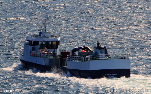
Vessel Mowi Star IMO: 9126027, MMSI: 257273900 Fish Carrier
UTC, 59.92483, 5.31345, course: 272, speed: 0
UTC, 59.92484, 5.31344, course: 274, speed: 0
2026-01-13 09:23:44 UTC, 60.07482, 5.13392, course: 350, speed: 9.3
Live AIS position:
UTC. Near Austevoll),
updated 2026-01-13 09:23:44 UTC.
Find the position of the vessel Mowi Star on the map. The latter are known coordinates and path.
marine traffic ship tracker show on live map
The current position of vessel Mowi Star is 60.07482 lat / 5.13392 lng. Updated: 2026-01-13 09:23:44 UTCCurrently sailing under the flag of Norway
Mowi Star built in 1996 year
Deadweight:
330 tDetails:
Last coordinates of the vessel:
UTC, 59.92482, 5.31344, course: 274, speed: 0UTC, 59.92483, 5.31345, course: 272, speed: 0
UTC, 59.92484, 5.31344, course: 274, speed: 0
2026-01-13 09:23:44 UTC, 60.07482, 5.13392, course: 350, speed: 9.3