 vesseltracker.com
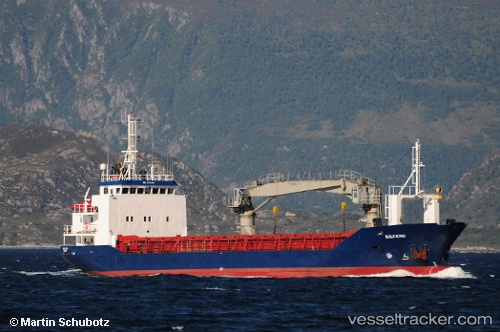
Vessel Gullaas IMO: 8700993, MMSI: 258326000 Deck Cargo Ship
UTC, 58.04081, 6.71328, course: 286, speed: 10.6
UTC, 58.15996, 6.41647, course: 312, speed: 10.2
2026-01-27 11:50:39 UTC, 58.40807, 5.87863, course: 314, speed: 11.3
Live AIS position:
UTC. Near Hellvik),
updated 2026-01-27 11:50:39 UTC.
Find the position of the vessel Gullaas on the map. The latter are known coordinates and path.
marine traffic ship tracker show on live map
The current position of vessel Gullaas is 58.40807 lat / 5.87863 lng. Updated: 2026-01-27 11:50:39 UTCCurrently sailing under the flag of Norway
Gullaas built in 1987 year
Deadweight:
1218 tDetails:
Last coordinates of the vessel:
UTC, 57.96165, 7.37841, course: 273, speed: 11.3UTC, 58.04081, 6.71328, course: 286, speed: 10.6
UTC, 58.15996, 6.41647, course: 312, speed: 10.2
2026-01-27 11:50:39 UTC, 58.40807, 5.87863, course: 314, speed: 11.3