 vesseltracker.com
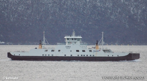
Find the position of the vessel Eira on the map. The latter are known coordinates and path.
marine traffic ship tracker show on live map
The current position of vessel Eira is 62.72911 lat / 6.98412 lng. Updated: 2025-11-03 09:55:27 UTCCurrently sailing under the flag of Norway
Eira built in 2002 year
Deadweight:
655 tDetails:
Last coordinates of the vessel:
UTC, 62.72345, 6.96199, course: 57, speed: 10.1UTC, 62.72864, 6.97924, course: 232, speed: 9
UTC, 62.72920, 6.98308, course: 257, speed: 5.5
2025-11-03 09:55:27 UTC, 62.72911, 6.98412, course: 101, speed: 2.3