 vesseltracker.com
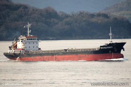
Vessel New Silk Road 2 IMO: 9682679, MMSI: 312808000 General Cargo Ship
UTC, 37.39241, 126.54388, course: 6, speed: 0
UTC, 37.39262, 126.54454, course: 297, speed: 0.3
2026-01-27 21:40:12 UTC, 37.39287, 126.54493, course: 287, speed: 0
Live AIS position:
UTC. Near Incheon),
updated 2026-01-27 21:40:12 UTC.
Find the position of the vessel New Silk Road 2 on the map. The latter are known coordinates and path.
marine traffic ship tracker show on live map
The current position of vessel New Silk Road 2 is 37.39287 lat / 126.54493 lng. Updated: 2026-01-27 21:40:12 UTCCurrently sailing under the flag of Belize
Details:
Last coordinates of the vessel:
UTC, 37.39238, 126.54385, course: 3, speed: 0.1UTC, 37.39241, 126.54388, course: 6, speed: 0
UTC, 37.39262, 126.54454, course: 297, speed: 0.3
2026-01-27 21:40:12 UTC, 37.39287, 126.54493, course: 287, speed: 0