 vesseltracker.com
Live AIS position:
48.42970° N, 70.87530° W UTC. Near GRANDE ANSE),
updated 2025-11-23 20:21:44 UTC.
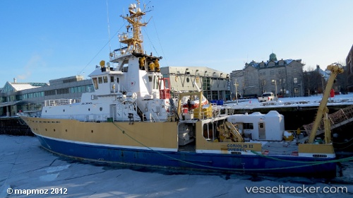
Find the position of the vessel Coriolis Ii on the map. The latter are known coordinates and path.
marine traffic ship tracker show on live map
The current position of vessel Coriolis Ii is 48.42970 lat / -70.87530 lng. Updated: 2025-11-23 20:21:44 UTCCurrently sailing under the flag of Canada
Coriolis Ii built in 1991 year
Deadweight:
290 tDetails:
Last coordinates of the vessel:
UTC, 48.41405, -70.83347, course: 101, speed: 0.6UTC, 48.41429, -70.83239, course: 107, speed: 0.3
UTC, 48.42970, -70.87530, course: 108, speed: 1.1
2025-11-23 20:21:44 UTC, 48.42970, -70.87530, course: 108, speed: 1.1