 vesseltracker.com
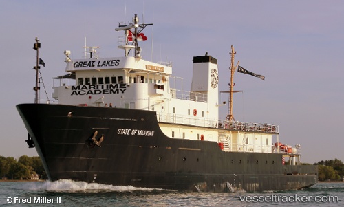
Vessel State Of Michigan IMO: 8835451, MMSI: 338940000 Training Ship
UTC, 44.76500, -85.60667, course: -1, speed: 0
UTC, 44.76500, -85.60667, course: -1, speed: 0
2026-01-27 21:42:58 UTC, 44.76500, -85.60667, course: -1, speed: 0
Live AIS position:
UTC. Near TRAVERSE CITY),
updated 2026-01-27 21:42:58 UTC.
Find the position of the vessel State Of Michigan on the map. The latter are known coordinates and path.
marine traffic ship tracker show on live map
The current position of vessel State Of Michigan is 44.76500 lat / -85.60667 lng. Updated: 2026-01-27 21:42:58 UTCDetails:
Last coordinates of the vessel:
UTC, 44.76500, -85.60667, course: -1, speed: 0UTC, 44.76500, -85.60667, course: -1, speed: 0
UTC, 44.76500, -85.60667, course: -1, speed: 0
2026-01-27 21:42:58 UTC, 44.76500, -85.60667, course: -1, speed: 0