 vesseltracker.com
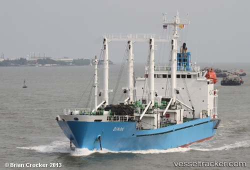
Vessel Dinok IMO: 8908234, MMSI: 352475000 Refrigerated Cargo Ship
UTC, 1.41270, 172.78592, course: 231, speed: 0.9
UTC, 1.42592, 172.76605, course: 238, speed: 0.8
2026-01-28 17:54:03 UTC, 1.42268, 172.88931, course: 110, speed: 5.8
Live AIS position:
UTC. Near Tarawa Atoll),
updated 2026-01-28 17:54:03 UTC.
Find the position of the vessel Dinok on the map. The latter are known coordinates and path.
marine traffic ship tracker show on live map
The current position of vessel Dinok is 1.42268 lat / 172.88931 lng. Updated: 2026-01-28 17:54:03 UTCDetails:
Last coordinates of the vessel:
UTC, 1.40222, 172.80965, course: 224, speed: 0.6UTC, 1.41270, 172.78592, course: 231, speed: 0.9
UTC, 1.42592, 172.76605, course: 238, speed: 0.8
2026-01-28 17:54:03 UTC, 1.42268, 172.88931, course: 110, speed: 5.8