 vesseltracker.com
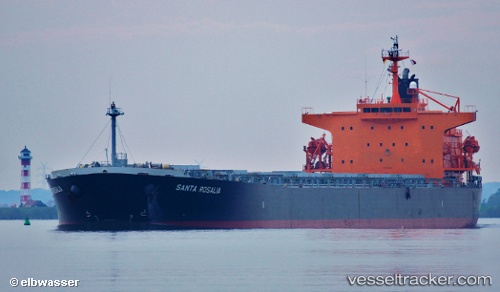
Vessel Santa Rosalia IMO: 9311189, MMSI: 354632000 Bulk Carrier
UTC, 49.29637, -123.25487, course: 84, speed: 0.1
UTC, 49.29530, -123.25373, course: 49, speed: 0.1
2026-01-28 05:44:44 UTC, 49.29617, -123.25612, course: 71, speed: 0.1
Live AIS position:
UTC. Near Burrard Inlet),
updated 2026-01-28 05:44:44 UTC.
Find the position of the vessel Santa Rosalia on the map. The latter are known coordinates and path.
marine traffic ship tracker show on live map
The current position of vessel Santa Rosalia is 49.29617 lat / -123.25612 lng. Updated: 2026-01-28 05:44:44 UTCDetails:
Last coordinates of the vessel:
UTC, 49.29818, -123.25038, course: 199, speed: 0UTC, 49.29637, -123.25487, course: 84, speed: 0.1
UTC, 49.29530, -123.25373, course: 49, speed: 0.1
2026-01-28 05:44:44 UTC, 49.29617, -123.25612, course: 71, speed: 0.1