 vesseltracker.com
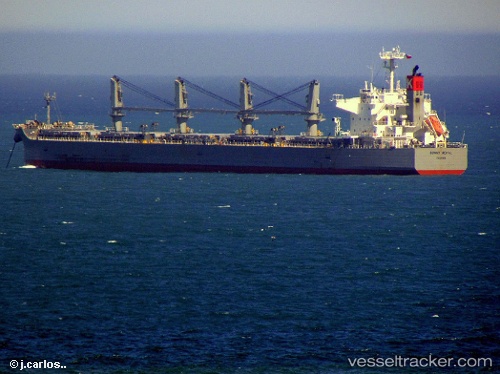
Vessel Sunny Royal IMO: 9482122, MMSI: 357213000 Bulk Carrier
UTC, -30.05860, 113.57630, course: 346, speed: 11.3
UTC, -29.65823, 113.46463, course: 347, speed: 11.2
2026-01-30 02:04:47 UTC, -29.22175, 113.35462, course: 347, speed: 10.9
Live AIS position:
UTC. 70 nm W of Geraldton),
updated 2026-01-30 02:04:47 UTC.
Find the position of the vessel Sunny Royal on the map. The latter are known coordinates and path.
marine traffic ship tracker show on live map
The current position of vessel Sunny Royal is -29.22175 lat / 113.35462 lng. Updated: 2026-01-30 02:04:47 UTCDetails:
Last coordinates of the vessel:
UTC, -30.40652, 113.67402, course: 345, speed: 11.1UTC, -30.05860, 113.57630, course: 346, speed: 11.3
UTC, -29.65823, 113.46463, course: 347, speed: 11.2
2026-01-30 02:04:47 UTC, -29.22175, 113.35462, course: 347, speed: 10.9