 vesseltracker.com
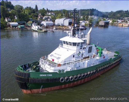
Vessel Denise Foss IMO: 9748576, MMSI: 367732430 Tug
UTC, 48.36850, -124.61315, course: 341, speed: 0
UTC, 48.36850, -124.61316, course: 341, speed: 0
2026-01-28 17:40:46 UTC, 48.36850, -124.61315, course: 340, speed: 0
Live AIS position:
UTC. Near Neah Bay),
updated 2026-01-28 17:40:46 UTC.
Find the position of the vessel Denise Foss on the map. The latter are known coordinates and path.
marine traffic ship tracker show on live map
The current position of vessel Denise Foss is 48.36850 lat / -124.61315 lng. Updated: 2026-01-28 17:40:46 UTCCurrently sailing under the flag of USA
Details:
Last coordinates of the vessel:
UTC, 48.36850, -124.61316, course: 341, speed: 0UTC, 48.36850, -124.61315, course: 341, speed: 0
UTC, 48.36850, -124.61316, course: 341, speed: 0
2026-01-28 17:40:46 UTC, 48.36850, -124.61315, course: 340, speed: 0