 vesseltracker.com
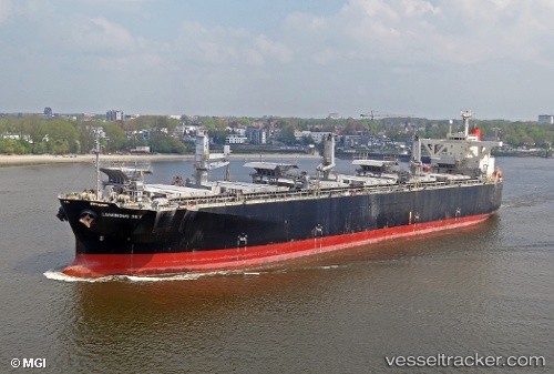
Vessel Luminous Sky IMO: 9303118, MMSI: 371493000 Wood Chips Carrier
UTC, 0.81942, 102.40150, course: 319, speed: 0
UTC, 0.81945, 102.40150, course: 319, speed: 0
2026-01-28 12:34:00 UTC, 0.81945, 102.40150, course: 319, speed: 0
Live AIS position:
UTC. Near FUTONG),
updated 2026-01-28 12:34:00 UTC.
Find the position of the vessel Luminous Sky on the map. The latter are known coordinates and path.
marine traffic ship tracker show on live map
The current position of vessel Luminous Sky is 0.81945 lat / 102.40150 lng. Updated: 2026-01-28 12:34:00 UTCDetails:
Last coordinates of the vessel:
UTC, 0.81938, 102.40152, course: 319, speed: 0UTC, 0.81942, 102.40150, course: 319, speed: 0
UTC, 0.81945, 102.40150, course: 319, speed: 0
2026-01-28 12:34:00 UTC, 0.81945, 102.40150, course: 319, speed: 0