 vesseltracker.com
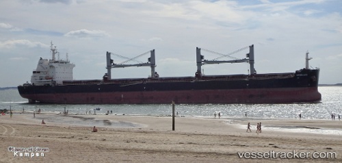
Vessel Menelaos IMO: 9696436, MMSI: 371919000 Bulk Carrier
UTC, 31.32333, 30.07167, course: -1, speed: 0
UTC, 31.32452, 30.07288, course: 179, speed: 0
2026-01-29 13:53:33 UTC, 31.32333, 30.07167, course: -1, speed: 0
Live AIS position:
UTC. Near ABU QIR),
updated 2026-01-29 13:53:33 UTC.
Find the position of the vessel Menelaos on the map. The latter are known coordinates and path.
marine traffic ship tracker show on live map
The current position of vessel Menelaos is 31.32333 lat / 30.07167 lng. Updated: 2026-01-29 13:53:33 UTCDetails:
Last coordinates of the vessel:
UTC, 31.32451, 30.07290, course: 179, speed: 0UTC, 31.32333, 30.07167, course: -1, speed: 0
UTC, 31.32452, 30.07288, course: 179, speed: 0
2026-01-29 13:53:33 UTC, 31.32333, 30.07167, course: -1, speed: 0