 vesseltracker.com
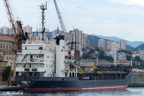
Vessel SEA BREEZE IMO: 7116781, MMSI: 511100757 Bulk Carrier
UTC, 31.20392, 33.78666, course: -1, speed: 0.3
UTC, 31.20333, 33.78667, course: -1, speed: 0
2026-01-28 20:05:50 UTC, 31.20404, 33.78660, course: -1, speed: 0.3
Live AIS position:
UTC. Near AL ARISH),
updated 2026-01-28 20:05:50 UTC.
Find the position of the vessel SEA BREEZE on the map. The latter are known coordinates and path.
marine traffic ship tracker show on live map
The current position of vessel SEA BREEZE is 31.20404 lat / 33.78660 lng. Updated: 2026-01-28 20:05:50 UTCCurrently sailing under the flag of Palau (Republic of)
SEA BREEZE built in 1972 year
Deadweight:
6370 tDetails:
Last coordinates of the vessel:
UTC, 31.20333, 33.78667, course: -1, speed: 0UTC, 31.20392, 33.78666, course: -1, speed: 0.3
UTC, 31.20333, 33.78667, course: -1, speed: 0
2026-01-28 20:05:50 UTC, 31.20404, 33.78660, course: -1, speed: 0.3