 vesseltracker.com
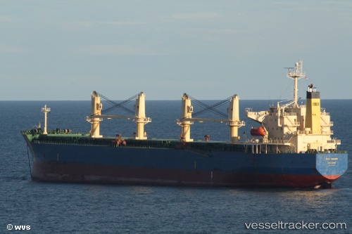
Vessel 'GUNALEILA' IMO: 9324083, MMSI: 525120014
UTC, -1.15835, 117.24383, course: 235, speed: 0
UTC, -1.16240, 117.24218, course: 35, speed: 0.5
2026-01-27 20:31:59 UTC, -1.16214, 117.24439, course: 321, speed: 0.1
Live AIS position:
UTC. Near Senipah Oil Terminal),
updated 2026-01-27 20:31:59 UTC.
Find the position of the vessel 'GUNALEILA' on the map. The latter are known coordinates and path.
marine traffic ship tracker show on live map
The current position of vessel 'GUNALEILA' is -1.16214 lat / 117.24439 lng. Updated: 2026-01-27 20:31:59 UTCDetails:
Last coordinates of the vessel:
UTC, -1.15865, 117.24380, course: 235, speed: 0UTC, -1.15835, 117.24383, course: 235, speed: 0
UTC, -1.16240, 117.24218, course: 35, speed: 0.5
2026-01-27 20:31:59 UTC, -1.16214, 117.24439, course: 321, speed: 0.1