 vesseltracker.com
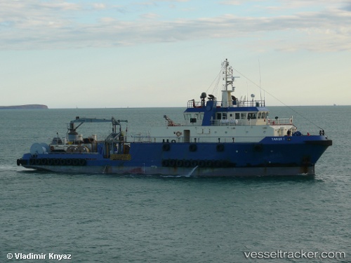
Find the position of the vessel Tanux I on the map. The latter are known coordinates and path.
marine traffic ship tracker show on live map
The current position of vessel Tanux I is 42.0356 lat / 33.8259 lng. Updated: 2025-05-29 20:41:36 UTCCurrently sailing under the flag of Marshall Is
Tanux I built in 2006 year
Deadweight:
949 tPayload_mass:
949 tonneGross tonnage:
1161Service entry:
2006-01-01T00:00:00ZDetails:
Last coordinates of the vessel:
UTC, 43.1396, 34.4295, course: 70, speed: 3.7UTC, 43.1396, 34.4295, course: 70, speed: 3.7
UTC, 42.1846, 33.9032, course: 197, speed: 10.6
2025-05-29 20:41:36 UTC, 42.0356, 33.8259, course: 201, speed: 10.4