 vesseltracker.com
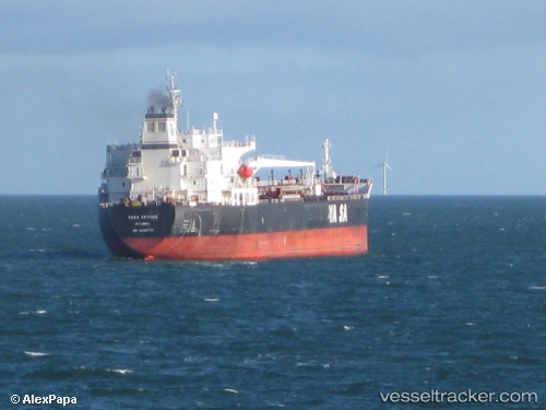
Vessel Ridgebury Cindy A IMO: 9439773, MMSI: 538005321 Chemical Oil Products Tanker
UTC, 19.68723, 57.69527, course: 185, speed: 0
UTC, 19.68725, 57.69523, course: 185, speed: 0
2026-02-01 08:13:31 UTC, 19.68727, 57.69522, course: 185, speed: 0
Live AIS position:
UTC. Near AL DUQM),
updated 2026-02-01 08:13:31 UTC.
Find the position of the vessel Ridgebury Cindy A on the map. The latter are known coordinates and path.
marine traffic ship tracker show on live map
The current position of vessel Ridgebury Cindy A is 19.68727 lat / 57.69522 lng. Updated: 2026-02-01 08:13:31 UTCCurrently sailing under the flag of Marshall Is
Ridgebury Cindy A built in 2008 year
Deadweight:
50162 tDetails:
Last coordinates of the vessel:
UTC, 19.68730, 57.69523, course: 185, speed: 0UTC, 19.68723, 57.69527, course: 185, speed: 0
UTC, 19.68725, 57.69523, course: 185, speed: 0
2026-02-01 08:13:31 UTC, 19.68727, 57.69522, course: 185, speed: 0