 vesseltracker.com
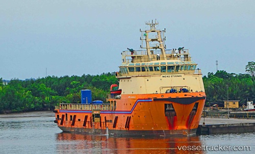
Vessel ANJALI IMO: 9720940, MMSI: 538005581 Offshore Supply Ship
UTC, 4.88541, -1.74537, course: 179, speed: 0
UTC, 4.88540, -1.74535, course: 178, speed: 0
2026-01-31 09:47:00 UTC, 4.88500, -1.74500, course: -1, speed: 0
Live AIS position:
UTC. Near Takoradi),
updated 2026-01-31 09:47:00 UTC.
Find the position of the vessel ANJALI on the map. The latter are known coordinates and path.
marine traffic ship tracker show on live map
The current position of vessel ANJALI is 4.88500 lat / -1.74500 lng. Updated: 2026-01-31 09:47:00 UTCCurrently sailing under the flag of Marshall Islands
ANJALI built in 2014 year
Deadweight:
4001 tDetails:
Last coordinates of the vessel:
UTC, 4.88541, -1.74535, course: 179, speed: 0UTC, 4.88541, -1.74537, course: 179, speed: 0
UTC, 4.88540, -1.74535, course: 178, speed: 0
2026-01-31 09:47:00 UTC, 4.88500, -1.74500, course: -1, speed: 0