 vesseltracker.com
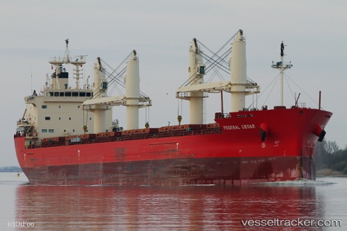
Find the position of the vessel Federal Cedar on the map. The latter are known coordinates and path.
marine traffic ship tracker show on live map
The current position of vessel Federal Cedar is 20.9549 lat / -97.3415 lng. Updated: 2025-05-12 07:14:47 UTCCurrently sailing under the flag of Marshall Is
Port of registry:
Majuro (capital of the Marshall Islands)Payload_mass:
34564 tonneGross tonnage:
20789Beam:
23.76 metreOperator:
Anglo-Eastern Ship ManagementService entry:
2016-01-01T00:00:00ZManufacturer:
Oshima Shipbuilding (Japanese shipbuilding company)Details:
Last coordinates of the vessel:
UTC, 20.9549, -97.3415, course: 232, speed: 0UTC, 20.9549, -97.3415, course: 233, speed: 0.1
UTC, 20.9549, -97.3415, course: 233, speed: 0
2025-05-12 07:14:47 UTC, 20.9549, -97.3415, course: 233, speed: 0.1