 vesseltracker.com
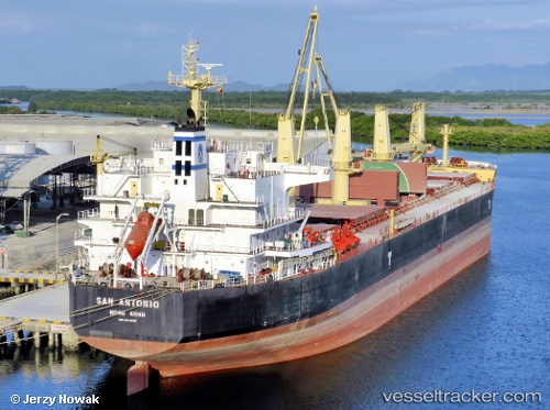
Vessel San Antonio IMO: 9514066, MMSI: 538007200 Bulk Carrier
UTC, 6.30192, 3.38968, course: 266, speed: 0.1
UTC, 6.30268, 3.38930, course: 236, speed: 0.1
2026-02-01 19:22:59 UTC, 6.30262, 3.38933, course: 236, speed: 0
Live AIS position:
UTC. Near Apapa),
updated 2026-02-01 19:22:59 UTC.
Find the position of the vessel San Antonio on the map. The latter are known coordinates and path.
marine traffic ship tracker show on live map
The current position of vessel San Antonio is 6.30262 lat / 3.38933 lng. Updated: 2026-02-01 19:22:59 UTCCurrently sailing under the flag of Marshall Is
San Antonio built in 2012 year
Deadweight:
55768 tDetails:
Last coordinates of the vessel:
UTC, 6.30237, 3.38945, course: 244, speed: 0UTC, 6.30192, 3.38968, course: 266, speed: 0.1
UTC, 6.30268, 3.38930, course: 236, speed: 0.1
2026-02-01 19:22:59 UTC, 6.30262, 3.38933, course: 236, speed: 0