 vesseltracker.com
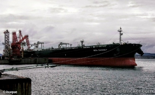
Find the position of the vessel Sea Garnet on the map. The latter are known coordinates and path.
marine traffic ship tracker show on live map
The current position of vessel Sea Garnet is 14.5266 lat / 120.632 lng. Updated: 2025-05-31 05:36:23 UTCCurrently sailing under the flag of Marshall Is
Port of registry:
Majuro (capital of the Marshall Islands)Payload_mass:
158288 tonneGross tonnage:
81364Manufacturer:
HD Hyundai Heavy Industries (South Korean shipbuilding manufacturer)
Details:
Last coordinates of the vessel:
UTC, 14.5264, 120.63, course: 143, speed: 0.1UTC, 14.5259, 120.63, course: 127, speed: 0
UTC, 14.5264, 120.631, course: 145, speed: 0.3
2025-05-31 05:36:23 UTC, 14.5266, 120.632, course: 195, speed: 0.1