 vesseltracker.com
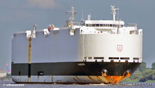
Find the position of the vessel VIKING PASSERO on the map. The latter are known coordinates and path.
marine traffic ship tracker show on live map
The current position of vessel VIKING PASSERO is 35.4931 lat / 139.765 lng. Updated: 2025-02-22 17:00:02 UTCCurrently sailing under the flag of Marshall Islands
VIKING PASSERO built in 2012 year
Port of registry:
Rostock (city in Mecklenburg-Vorpommern, Germany)Speed:
21 knotDeadweight:
12755 tPayload_mass:
12754.5 tonneGross tonnage:
47053Service entry:
2012-01-01T00:00:00ZDetails:
Last coordinates of the vessel:
UTC, 35.4931, 139.765, course: 242, speed: 0UTC, 35.4931, 139.765, course: 242, speed: 0
UTC, 35.4931, 139.765, course: 242, speed: 0
2025-02-22 17:00:02 UTC, 35.4931, 139.765, course: 242, speed: 0