 vesseltracker.com
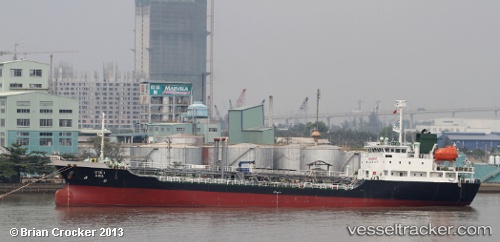
Vessel Ama IMO: 9114983, MMSI: 567061800 Chemical Oil Products Tanker
UTC, 4.99667, 118.36333, course: -1, speed: 0
UTC, 4.99667, 118.36333, course: -1, speed: 0
2026-01-30 11:30:14 UTC, 5.00333, 118.35833, course: -1, speed: 5
Live AIS position:
UTC. Near LAHAD DATU),
updated 2026-01-30 11:30:14 UTC.
Find the position of the vessel Ama on the map. The latter are known coordinates and path.
marine traffic ship tracker show on live map
The current position of vessel Ama is 5.00333 lat / 118.35833 lng. Updated: 2026-01-30 11:30:14 UTCDetails:
Last coordinates of the vessel:
UTC, 4.99667, 118.36333, course: -1, speed: 0UTC, 4.99667, 118.36333, course: -1, speed: 0
UTC, 4.99667, 118.36333, course: -1, speed: 0
2026-01-30 11:30:14 UTC, 5.00333, 118.35833, course: -1, speed: 5