 vesseltracker.com
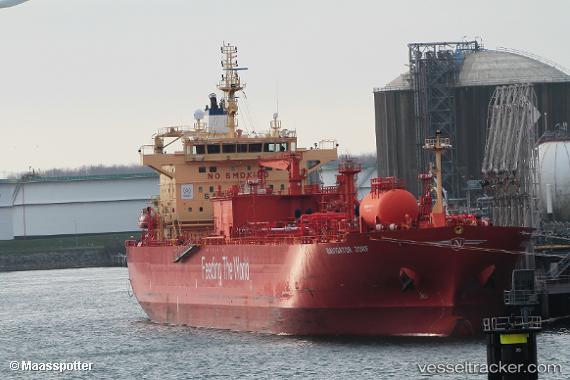
Vessel Navigator Jorf IMO: 9796339, MMSI: 636017997 Lpg Tanker
UTC, 30.54667, 19.62667, course: -1, speed: 0
UTC, 30.54667, 19.62667, course: -1, speed: 0
2026-01-28 16:10:48 UTC, 30.54667, 19.62667, course: -1, speed: 0
Live AIS position:
UTC. Near Marsa Al Burayqah),
updated 2026-01-28 16:10:48 UTC.
Find the position of the vessel Navigator Jorf on the map. The latter are known coordinates and path.
marine traffic ship tracker show on live map
The current position of vessel Navigator Jorf is 30.54667 lat / 19.62667 lng. Updated: 2026-01-28 16:10:48 UTCCurrently sailing under the flag of Liberia
Details:
Last coordinates of the vessel:
UTC, 30.54800, 19.62731, course: 237, speed: 0.1UTC, 30.54667, 19.62667, course: -1, speed: 0
UTC, 30.54667, 19.62667, course: -1, speed: 0
2026-01-28 16:10:48 UTC, 30.54667, 19.62667, course: -1, speed: 0