 vesseltracker.com
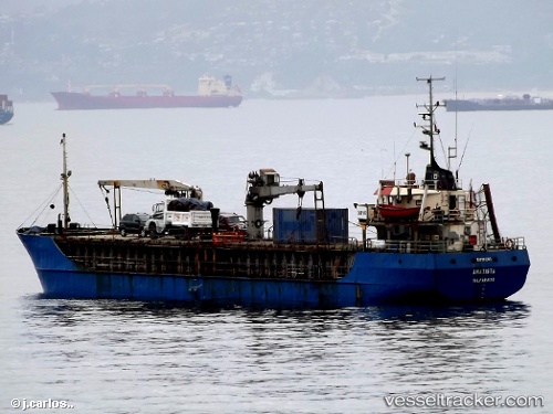
Vessel Amatista IMO: 7312141, MMSI: 725014800 General Cargo Ship
UTC, -43.93756, -73.39828, course: -1, speed: 6.6
UTC, -44.16848, -73.41102, course: -1, speed: 6.2
2026-01-29 13:55:58 UTC, -44.44728, -73.45979, course: -1, speed: 7.4
Live AIS position:
UTC. 37 nm NW of Puerto Cisnes),
updated 2026-01-29 13:55:58 UTC.
Find the position of the vessel Amatista on the map. The latter are known coordinates and path.
marine traffic ship tracker show on live map
The current position of vessel Amatista is -44.44728 lat / -73.45979 lng. Updated: 2026-01-29 13:55:58 UTCDetails:
Last coordinates of the vessel:
UTC, -43.80452, -73.40319, course: -1, speed: 6.8UTC, -43.93756, -73.39828, course: -1, speed: 6.6
UTC, -44.16848, -73.41102, course: -1, speed: 6.2
2026-01-29 13:55:58 UTC, -44.44728, -73.45979, course: -1, speed: 7.4