 vesseltracker.com
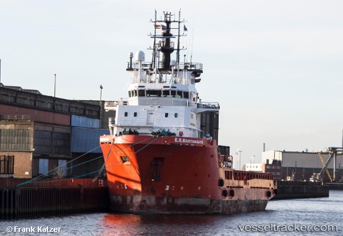
Vessel FS KRISTIANSAND IMO: 9350240, MMSI: 209670000 Offshore Supply Ship
UTC, 32.29668, -9.33425, course: 322, speed: 0.7
UTC, 32.29668, -9.33425, course: 322, speed: 0.7
2026-03-01 11:17:17 UTC, 32.29668, -9.33425, course: 322, speed: 0.7
Live AIS position:
UTC. Near Safi),
updated 2026-03-01 11:17:17 UTC.
Find the position of the vessel FS KRISTIANSAND on the map. The latter are known coordinates and path.
marine traffic ship tracker show on live map
The current position of vessel FS KRISTIANSAND is 32.29668 lat / -9.33425 lng. Updated: 2026-03-01 11:17:17 UTCCurrently sailing under the flag of Cyprus
FS KRISTIANSAND built in 2005 year
Deadweight:
3544 tDetails:
Last coordinates of the vessel:
UTC, 32.29671, -9.33466, course: -1, speed: 0.6UTC, 32.29668, -9.33425, course: 322, speed: 0.7
UTC, 32.29668, -9.33425, course: 322, speed: 0.7
2026-03-01 11:17:17 UTC, 32.29668, -9.33425, course: 322, speed: 0.7