 vesseltracker.com
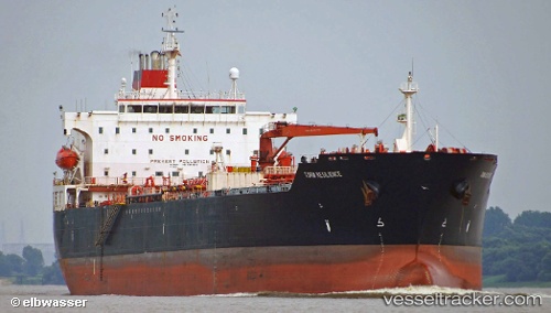
Vessel PEACE GULF IMO: 9304588, MMSI: 352005406 Oil Products Tanker
UTC, 25.29030, 56.54326, course: 133, speed: 0
UTC, 25.29014, 56.54319, course: -1, speed: 0
2026-03-02 00:18:15 UTC, 25.29071, 56.54392, course: -1, speed: 0
Live AIS position:
UTC. Near Offshore Fujairah),
updated 2026-03-02 00:18:15 UTC.
Find the position of the vessel PEACE GULF on the map. The latter are known coordinates and path.
marine traffic ship tracker show on live map
The current position of vessel PEACE GULF is 25.29071 lat / 56.54392 lng. Updated: 2026-03-02 00:18:15 UTCCurrently sailing under the flag of Panama
Details:
Last coordinates of the vessel:
UTC, 25.29020, 56.54326, course: -1, speed: 0UTC, 25.29030, 56.54326, course: 133, speed: 0
UTC, 25.29014, 56.54319, course: -1, speed: 0
2026-03-02 00:18:15 UTC, 25.29071, 56.54392, course: -1, speed: 0