 vesseltracker.com
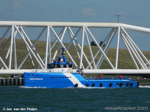
Vessel FAMAR INTERVENTION IMO: 9779068, MMSI: 210823000 Other Type
UTC, -4.78078, 11.85039, course: 282, speed: 0
UTC, -4.78076, 11.85038, course: 283, speed: 0
2026-03-04 01:33:45 UTC, -4.78076, 11.85040, course: 283, speed: 0
Live AIS position:
UTC. Near Pointe Noire),
updated 2026-03-04 01:33:45 UTC.
Find the position of the vessel FAMAR INTERVENTION on the map. The latter are known coordinates and path.
marine traffic ship tracker show on live map
The current position of vessel FAMAR INTERVENTION is -4.78076 lat / 11.85040 lng. Updated: 2026-03-04 01:33:45 UTCDetails:
Last coordinates of the vessel:
UTC, -4.78082, 11.85040, course: 282, speed: 0UTC, -4.78078, 11.85039, course: 282, speed: 0
UTC, -4.78076, 11.85038, course: 283, speed: 0
2026-03-04 01:33:45 UTC, -4.78076, 11.85040, course: 283, speed: 0