 vesseltracker.com
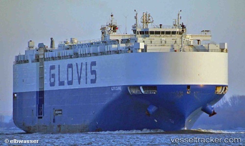
Find the position of the vessel '441168000' on the map. The latter are known coordinates and path.
marine traffic ship tracker show on live map
The current position of vessel '441168000' is -18.6475 lat / 54.9149 lng. Updated: 2025-02-08 14:15:26 UTCPayload_mass:
20661 tonneGross tonnage:
59060Beam:
32 metreService entry:
2013-01-01T00:00:00ZManufacturer:
HD Hyundai Samho (Korean shipbuilding company)Details:
Last coordinates of the vessel:
UTC, -17.923, 55.6098, course: 222, speed: 15.3UTC, -18.1206, 55.4205, course: 222, speed: 15.6
UTC, -18.3031, 55.244, course: 222, speed: 15.3
2025-02-08 14:15:26 UTC, -18.6475, 54.9149, course: 223, speed: 15.2