 vesseltracker.com
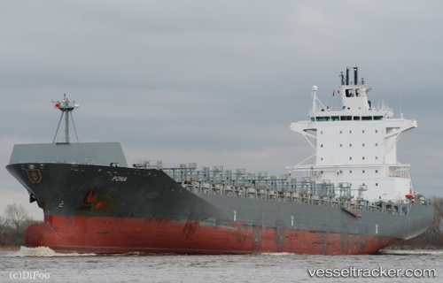
Vessel PONA IMO: 9349875, MMSI: 636092984 Container Ship
UTC, 32.90167, 126.89500, course: -1, speed: 0
UTC, 32.88333, 126.89500, course: -1, speed: 0
2026-03-22 23:47:51 UTC, 32.86667, 126.86500, course: -1, speed: 1
Live Vessel PONA Analytics (details, animations, etc.)
Live AIS position: UTC. 27 nm SE of Seogwipo), updated 2026-03-22 23:47:51 UTC.Find the position of the vessel PONA on the map. The latter are known coordinates and path.
marine traffic ship tracker show on live map
The current position of vessel PONA is 32.86667 lat / 126.86500 lng. Updated: 2026-03-22 23:47:51 UTCCurrently sailing under the flag of Liberia
PONA built in 2007 year
Deadweight:
37905 tDetails:
Last coordinates of the vessel:
UTC, 32.91333, 126.92167, course: -1, speed: 0UTC, 32.90167, 126.89500, course: -1, speed: 0
UTC, 32.88333, 126.89500, course: -1, speed: 0
2026-03-22 23:47:51 UTC, 32.86667, 126.86500, course: -1, speed: 1