 vesseltracker.com
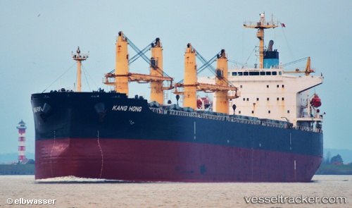
Vessel KANG HONG IMO: 9323558, MMSI: 412348000 Bulk Carrier
UTC, 5.21333, 93.95333, course: -1, speed: 11
UTC, 5.44333, 94.24667, course: -1, speed: 11
2026-03-17 01:26:55 UTC, 5.68500, 94.53667, course: -1, speed: 12
Live Vessel KANG HONG Analytics (details, animations, etc.)
Live AIS position: UTC. 44 nm W of LHOKNGA), updated 2026-03-17 01:26:55 UTC.Find the position of the vessel KANG HONG on the map. The latter are known coordinates and path.
marine traffic ship tracker show on live map
The current position of vessel KANG HONG is 5.68500 lat / 94.53667 lng. Updated: 2026-03-17 01:26:55 UTCCurrently sailing under the flag of China Peopless Republic
KANG HONG built in 2005 year
Deadweight:
55589 tDetails:
Last coordinates of the vessel:
UTC, 4.98333, 93.66500, course: -1, speed: 11UTC, 5.21333, 93.95333, course: -1, speed: 11
UTC, 5.44333, 94.24667, course: -1, speed: 11
2026-03-17 01:26:55 UTC, 5.68500, 94.53667, course: -1, speed: 12