 vesseltracker.com
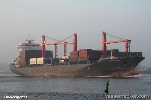
Vessel MAERSK BAHAMAS IMO: 9697026, MMSI: 563096500 Container Ship
UTC, 10.25167, 123.87333, course: -1, speed: 0
UTC, 10.25167, 123.87333, course: -1, speed: 0
2026-03-09 18:31:14 UTC, 10.25167, 123.87333, course: -1, speed: 0
Live Vessel MAERSK BAHAMAS Analytics (details, animations, etc.)
Live AIS position: UTC. Near Laguna), updated 2026-03-09 18:31:14 UTC.Find the position of the vessel MAERSK BAHAMAS on the map. The latter are known coordinates and path.
marine traffic ship tracker show on live map
The current position of vessel MAERSK BAHAMAS is 10.25167 lat / 123.87333 lng. Updated: 2026-03-09 18:31:14 UTCCurrently sailing under the flag of Singapore
MAERSK BAHAMAS built in 2016 year
Deadweight:
35225 tDetails:
Last coordinates of the vessel:
UTC, 10.25322, 123.87380, course: -1, speed: 0UTC, 10.25167, 123.87333, course: -1, speed: 0
UTC, 10.25167, 123.87333, course: -1, speed: 0
2026-03-09 18:31:14 UTC, 10.25167, 123.87333, course: -1, speed: 0