 vesseltracker.com
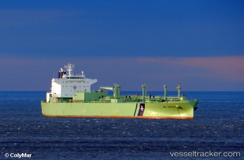
Vessel 'NANTES' IMO: 9253818, MMSI: 257568000
UTC, 15.06092, -100.29633, course: 139, speed: 12.9
UTC, 14.85833, -100.09167, course: -1, speed: 13
2026-02-05 15:57:21 UTC, 14.49911, -99.73607, course: 137, speed: 13.4
Live AIS position:
UTC. 140 nm SW of Cuajinicuilapa),
updated 2026-02-05 15:57:21 UTC.
Find the position of the vessel 'NANTES' on the map. The latter are known coordinates and path.
marine traffic ship tracker show on live map
The current position of vessel 'NANTES' is 14.49911 lat / -99.73607 lng. Updated: 2026-02-05 15:57:21 UTCDetails:
Last coordinates of the vessel:
UTC, 15.47167, -100.71000, course: -1, speed: 13UTC, 15.06092, -100.29633, course: 139, speed: 12.9
UTC, 14.85833, -100.09167, course: -1, speed: 13
2026-02-05 15:57:21 UTC, 14.49911, -99.73607, course: 137, speed: 13.4