 vesseltracker.com
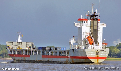
Vessel ARCTICA 2 IMO: 9243801, MMSI: 273370990 Cargo/Containership
UTC, 64.59333, 40.50167, course: -1, speed: 0
UTC, 64.59333, 40.50167, course: -1, speed: 0
2026-02-22 23:59:54 UTC, 64.59333, 40.50167, course: -1, speed: 0
Live AIS position:
UTC. Near ARKHANGELSK),
updated 2026-02-22 23:59:54 UTC.
Find the position of the vessel ARCTICA 2 on the map. The latter are known coordinates and path.
marine traffic ship tracker show on live map
The current position of vessel ARCTICA 2 is 64.59333 lat / 40.50167 lng. Updated: 2026-02-22 23:59:54 UTCCurrently sailing under the flag of Russia
ARCTICA 2 built in 2002 year
Deadweight:
9150 tDetails:
Last coordinates of the vessel:
UTC, 64.59333, 40.50167, course: -1, speed: 0UTC, 64.59333, 40.50167, course: -1, speed: 0
UTC, 64.59333, 40.50167, course: -1, speed: 0
2026-02-22 23:59:54 UTC, 64.59333, 40.50167, course: -1, speed: 0