 vesseltracker.com
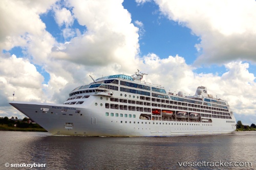
Vessel AZAMARA ONWARD IMO: 9187887, MMSI: 538012042 Passengers Ship
UTC, -19.50068, 147.96747, course: 294, speed: 16.9
UTC, -19.15327, 147.51462, course: 309, speed: 17.4
2026-03-08 07:44:16 UTC, -18.72306, 146.97110, course: 310, speed: 17.1
Live Vessel AZAMARA ONWARD Analytics (details, animations, etc.)
Live AIS position: UTC. 27 nm N of NELLY BAY), updated 2026-03-08 07:44:16 UTC.Find the position of the vessel AZAMARA ONWARD on the map. The latter are known coordinates and path.
marine traffic ship tracker show on live map
The current position of vessel AZAMARA ONWARD is -18.72306 lat / 146.97110 lng. Updated: 2026-03-08 07:44:16 UTCCurrently sailing under the flag of Marshall Islands
Details:
Last coordinates of the vessel:
UTC, -19.75460, 148.54713, course: 304, speed: 17.4UTC, -19.50068, 147.96747, course: 294, speed: 16.9
UTC, -19.15327, 147.51462, course: 309, speed: 17.4
2026-03-08 07:44:16 UTC, -18.72306, 146.97110, course: 310, speed: 17.1