 vesseltracker.com
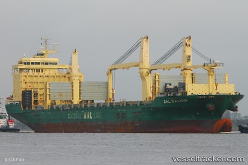
Vessel Aal Dalian IMO: 9498470, MMSI: 636018145 Multi Purpose Carrier
UTC, 16.76185, -162.03751, course: 286, speed: 14.3
UTC, 16.93765, -162.64064, course: 283, speed: 13.5
2026-02-15 15:28:43 UTC, 17.00471, -162.87067, course: 283, speed: 13.4
Live AIS position:
UTC. 347 nm SW of Port Allen),
updated 2026-02-15 15:28:43 UTC.
Find the position of the vessel Aal Dalian on the map. The latter are known coordinates and path.
marine traffic ship tracker show on live map
The current position of vessel Aal Dalian is 17.00471 lat / -162.87067 lng. Updated: 2026-02-15 15:28:43 UTCCurrently sailing under the flag of Liberia
Aal Dalian built in 2013 year
Deadweight:
31000 tDetails:
Last coordinates of the vessel:
UTC, 16.66321, -161.69955, course: 287, speed: 13.9UTC, 16.76185, -162.03751, course: 286, speed: 14.3
UTC, 16.93765, -162.64064, course: 283, speed: 13.5
2026-02-15 15:28:43 UTC, 17.00471, -162.87067, course: 283, speed: 13.4