 vesseltracker.com
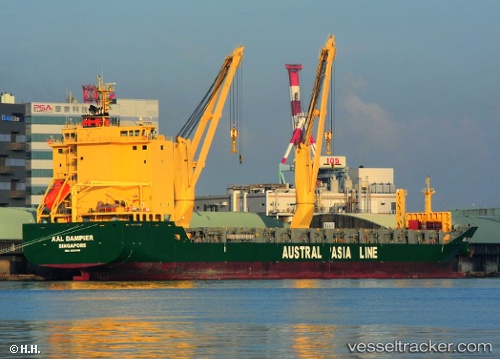
Vessel AAL DAMPIER IMO: 9521540, MMSI: 210418000 General Cargo Ship
UTC, 25.00092, 150.15903, course: 269, speed: 13.3
UTC, 25.00191, 149.50829, course: 270, speed: 12.4
2026-03-03 15:53:56 UTC, 24.99816, 149.10406, course: 273, speed: 13.1
Live AIS position:
UTC. 394 nm E of Omura),
updated 2026-03-03 15:53:56 UTC.
Find the position of the vessel AAL DAMPIER on the map. The latter are known coordinates and path.
marine traffic ship tracker show on live map
The current position of vessel AAL DAMPIER is 24.99816 lat / 149.10406 lng. Updated: 2026-03-03 15:53:56 UTCCurrently sailing under the flag of Cyprus
AAL DAMPIER built in 2011 year
Deadweight:
18707 tDetails:
Last coordinates of the vessel:
UTC, 24.99848, 150.48282, course: 274, speed: 13.4UTC, 25.00092, 150.15903, course: 269, speed: 13.3
UTC, 25.00191, 149.50829, course: 270, speed: 12.4
2026-03-03 15:53:56 UTC, 24.99816, 149.10406, course: 273, speed: 13.1