 vesseltracker.com
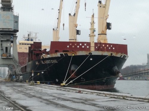
Vessel Aal Gladstone IMO: 9393541, MMSI: 212669000 Multi Purpose Carrier
UTC, -13.38667, 1.03833, course: -1, speed: 13
UTC, -13.07667, 0.79667, course: -1, speed: 12
2026-03-17 03:24:53 UTC, -12.78715, 0.57790, course: 322, speed: 12.8
Live Vessel Aal Gladstone Analytics (details, animations, etc.)
Live AIS position: UTC. 391 nm E of Levelwood), updated 2026-03-17 03:24:53 UTC.Find the position of the vessel Aal Gladstone on the map. The latter are known coordinates and path.
marine traffic ship tracker show on live map
The current position of vessel Aal Gladstone is -12.78715 lat / 0.57790 lng. Updated: 2026-03-17 03:24:53 UTCDetails:
Last coordinates of the vessel:
UTC, -13.76833, 1.33833, course: -1, speed: 12UTC, -13.38667, 1.03833, course: -1, speed: 13
UTC, -13.07667, 0.79667, course: -1, speed: 12
2026-03-17 03:24:53 UTC, -12.78715, 0.57790, course: 322, speed: 12.8