 vesseltracker.com
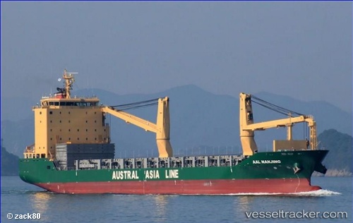
Vessel AAL NANJING IMO: 9521552, MMSI: 210461000 General Cargo Ship
UTC, -19.89136, 118.38322, course: -1, speed: 0
UTC, -19.89033, 118.38330, course: -1, speed: 0
2026-02-25 22:29:39 UTC, -19.88960, 118.38237, course: 210, speed: 0.1
Live AIS position:
UTC. 27 nm NW of Port Hedland),
updated 2026-02-25 22:29:39 UTC.
Find the position of the vessel AAL NANJING on the map. The latter are known coordinates and path.
marine traffic ship tracker show on live map
The current position of vessel AAL NANJING is -19.88960 lat / 118.38237 lng. Updated: 2026-02-25 22:29:39 UTCCurrently sailing under the flag of Cyprus
AAL NANJING built in 2012 year
Deadweight:
18697 tDetails:
Last coordinates of the vessel:
UTC, -19.89218, 118.38269, course: 319, speed: 0UTC, -19.89136, 118.38322, course: -1, speed: 0
UTC, -19.89033, 118.38330, course: -1, speed: 0
2026-02-25 22:29:39 UTC, -19.88960, 118.38237, course: 210, speed: 0.1