 vesseltracker.com
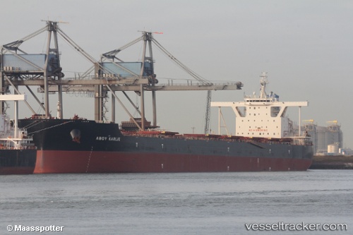
Vessel STAR KARLIE IMO: 9756236, MMSI: 636020462 Bulk Carrier
UTC, 19.43500, 120.05167, course: -1, speed: 10
UTC, 19.17191, 119.90183, course: -1, speed: 10.9
2026-03-17 03:31:39 UTC, 18.84912, 119.72323, course: -1, speed: 11.9
Live Vessel STAR KARLIE Analytics (details, animations, etc.)
Live AIS position: UTC. 61 nm W of Bangui), updated 2026-03-17 03:31:39 UTC.Find the position of the vessel STAR KARLIE on the map. The latter are known coordinates and path.
marine traffic ship tracker show on live map
The current position of vessel STAR KARLIE is 18.84912 lat / 119.72323 lng. Updated: 2026-03-17 03:31:39 UTCCurrently sailing under the flag of Liberia
STAR KARLIE built in 2016 year
Deadweight:
207566 tDetails:
Last coordinates of the vessel:
UTC, 19.72920, 120.23862, course: -1, speed: 10.8UTC, 19.43500, 120.05167, course: -1, speed: 10
UTC, 19.17191, 119.90183, course: -1, speed: 10.9
2026-03-17 03:31:39 UTC, 18.84912, 119.72323, course: -1, speed: 11.9