 vesseltracker.com
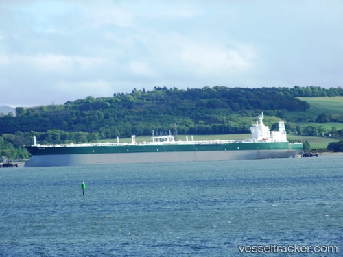
Vessel ABIE IMO: 9247182, MMSI: 314001111 Crude Oil Tanker
UTC, 35.24833, 121.06667, course: -1, speed: 10
UTC, 35.24167, 120.99333, course: -1, speed: 0
2026-03-09 16:07:42 UTC, 35.24508, 120.99546, course: 274, speed: 0.1
Live Vessel ABIE Analytics (details, animations, etc.)
Live AIS position: UTC. 59 nm SE of Xianlang), updated 2026-03-09 16:07:42 UTC.Find the position of the vessel ABIE on the map. The latter are known coordinates and path.
marine traffic ship tracker show on live map
The current position of vessel ABIE is 35.24508 lat / 120.99546 lng. Updated: 2026-03-09 16:07:42 UTCCurrently sailing under the flag of Barbados
Details:
Last coordinates of the vessel:
UTC, 35.36500, 121.66500, course: -1, speed: 10UTC, 35.24833, 121.06667, course: -1, speed: 10
UTC, 35.24167, 120.99333, course: -1, speed: 0
2026-03-09 16:07:42 UTC, 35.24508, 120.99546, course: 274, speed: 0.1