 vesseltracker.com
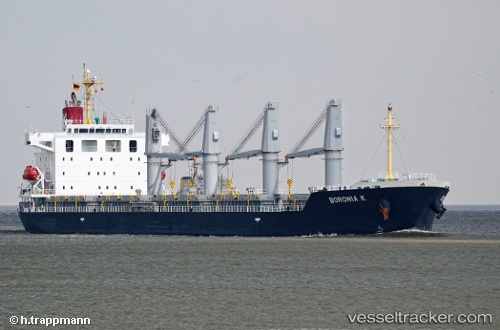
Vessel ACACIA IMO: 9597642, MMSI: 538009124 General Cargo Ship
UTC, 3.43562, -47.82579, course: 307, speed: 13.5
UTC, 3.91731, -48.57931, course: 305, speed: 13.8
2026-02-26 00:03:07 UTC, 4.13947, -48.92490, course: 306, speed: 13.8
Live AIS position:
UTC. 192 nm E of Regina),
updated 2026-02-26 00:03:07 UTC.
Find the position of the vessel ACACIA on the map. The latter are known coordinates and path.
marine traffic ship tracker show on live map
The current position of vessel ACACIA is 4.13947 lat / -48.92490 lng. Updated: 2026-02-26 00:03:07 UTCCurrently sailing under the flag of Marshall Islands
ACACIA built in 2011 year
Deadweight:
33677 tDetails:
Last coordinates of the vessel:
UTC, 3.11103, -47.27428, course: 297, speed: 14UTC, 3.43562, -47.82579, course: 307, speed: 13.5
UTC, 3.91731, -48.57931, course: 305, speed: 13.8
2026-02-26 00:03:07 UTC, 4.13947, -48.92490, course: 306, speed: 13.8