 vesseltracker.com
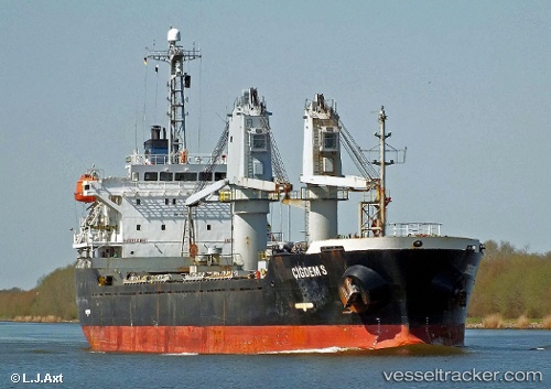
Vessel A LINE IMO: 9246920, MMSI: 314715000 Bulk Carrier
UTC, 44.54125, 37.12622, course: -1, speed: 1.8
UTC, 44.54125, 37.12622, course: -1, speed: 1.8
2026-02-25 14:28:11 UTC, 44.53523, 37.02385, course: 44, speed: 2.2
Live AIS position:
UTC. 28 nm W of Cpc Terminal),
updated 2026-02-25 14:28:11 UTC.
Find the position of the vessel A LINE on the map. The latter are known coordinates and path.
marine traffic ship tracker show on live map
The current position of vessel A LINE is 44.53523 lat / 37.02385 lng. Updated: 2026-02-25 14:28:11 UTCCurrently sailing under the flag of Barbados
Details:
Last coordinates of the vessel:
UTC, 44.54125, 37.12622, course: -1, speed: 1.8UTC, 44.54125, 37.12622, course: -1, speed: 1.8
UTC, 44.54125, 37.12622, course: -1, speed: 1.8
2026-02-25 14:28:11 UTC, 44.53523, 37.02385, course: 44, speed: 2.2