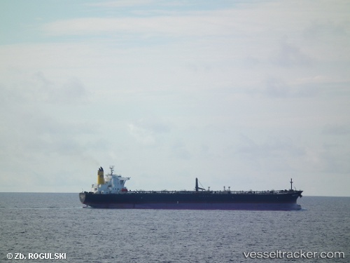
vessel REDBUD IMO: 9259197, Crude Oil Tanker vesseltracker.com
Vessel REDBUD IMO: 9259197, Crude Oil Tanker
MMSI: 636021588 callsign: 5LER8 size: 42x247

Find the position of the vessel REDBUD on the map. The latter are known coordinates and path.

marine traffic ship tracker show on live map

The current position of vessel REDBUD is 20.2296 lat / 110.125 lng. Updated: 2024-04-14 23:16:01 UTC

Currently sailing under the flag of Liberia

REDBUD built in 2003 year

Port of registry:
Majuro (coral atoll, capital of the Marshall Islands)
Deadweight:
107127 t

Payload_mass:
107127 tonne
Gross tonnage:
57979
Service entry:
2003-01-01T00:00:00Z

Manufacturer:
Imabari Shipbuilding (Japanese shipbuilder)

Details:


Last coordinates of the vessel:
UTC, 20.2296, 110.125, course: 181, speed: 0
2024-04-14 23:16:01 UTC, 20.2296, 110.125, course: 181, speed: 0

Track of the vessel in the last 14 days


Most frequent ports a vessels calls at REDBUD (636021588):

Yeosu, traffic: 1
Yosu, traffic: 1
Genova, traffic: 1
Qingdao, traffic: 1

Link to the map:


Find another ship

REDBUD (636021588) last ports (portcalls and passsages)

Genova | 2023-03-14 14:48:57
Yeosu | 2022-01-22 12:29:55