 vesseltracker.com
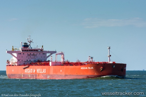
Vessel KIRA K IMO: 9346720, MMSI: 352002809 Crude Oil Tanker
UTC, 35.12322, 120.51977, course: 114, speed: 0
UTC, 35.12253, 120.51947, course: 97, speed: 0
2026-02-25 13:07:04 UTC, 35.12188, 120.51938, course: 94, speed: 0
Live AIS position:
UTC. 45 nm SE of DONGJIAKOU),
updated 2026-02-25 13:07:04 UTC.
Find the position of the vessel KIRA K on the map. The latter are known coordinates and path.
marine traffic ship tracker show on live map
The current position of vessel KIRA K is 35.12188 lat / 120.51938 lng. Updated: 2026-02-25 13:07:04 UTCCurrently sailing under the flag of Panama
KIRA K built in 2007 year
Deadweight:
115878 tDetails:
Last coordinates of the vessel:
UTC, 35.12377, 120.52357, course: -1, speed: 0UTC, 35.12322, 120.51977, course: 114, speed: 0
UTC, 35.12253, 120.51947, course: 97, speed: 0
2026-02-25 13:07:04 UTC, 35.12188, 120.51938, course: 94, speed: 0