 vesseltracker.com
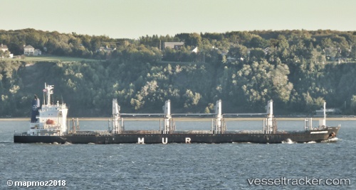
Vessel African Harrier IMO: 9700794, MMSI: 311000259 Bulk Carrier
UTC, 34.86452, 127.76096, course: -1, speed: 0
UTC, 34.86454, 127.76095, course: -1, speed: 0
2026-02-28 03:12:59 UTC, 34.86456, 127.76098, course: -1, speed: 0
Live AIS position:
UTC. Near Sangam-dong),
updated 2026-02-28 03:12:59 UTC.
Find the position of the vessel African Harrier on the map. The latter are known coordinates and path.
marine traffic ship tracker show on live map
The current position of vessel African Harrier is 34.86456 lat / 127.76098 lng. Updated: 2026-02-28 03:12:59 UTCDetails:
Last coordinates of the vessel:
UTC, 34.86453, 127.76093, course: -1, speed: 0UTC, 34.86452, 127.76096, course: -1, speed: 0
UTC, 34.86454, 127.76095, course: -1, speed: 0
2026-02-28 03:12:59 UTC, 34.86456, 127.76098, course: -1, speed: 0