 vesseltracker.com
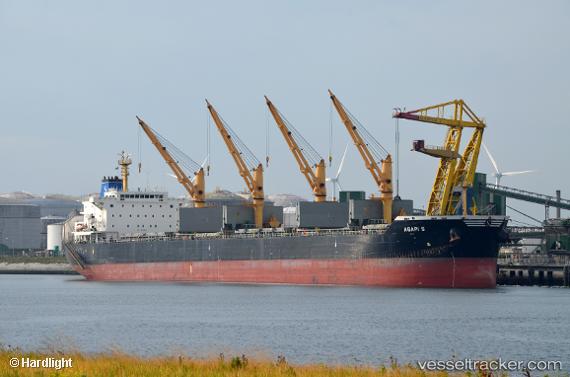
Vessel Agapi S IMO: 9514822, MMSI: 636015430 Bulk Carrier
UTC, 54.68022, 10.78422, course: 326, speed: 8.8
UTC, 54.89431, 10.85851, course: 6, speed: 6.7
2026-02-27 05:26:00 UTC, 55.12507, 10.98986, course: 1, speed: 9.3
Live AIS position:
UTC. Near Lundeborg),
updated 2026-02-27 05:26:00 UTC.
Find the position of the vessel Agapi S on the map. The latter are known coordinates and path.
marine traffic ship tracker show on live map
The current position of vessel Agapi S is 55.12507 lat / 10.98986 lng. Updated: 2026-02-27 05:26:00 UTCDetails:
Last coordinates of the vessel:
UTC, 54.56213, 11.33427, course: 293, speed: 9.7UTC, 54.68022, 10.78422, course: 326, speed: 8.8
UTC, 54.89431, 10.85851, course: 6, speed: 6.7
2026-02-27 05:26:00 UTC, 55.12507, 10.98986, course: 1, speed: 9.3