 vesseltracker.com
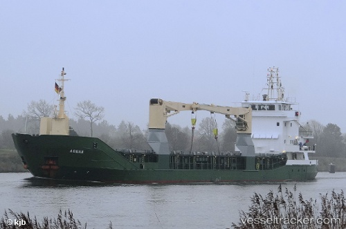
Vessel Agena IMO: 9197430, MMSI: 304221000 Multi Purpose Carrier
UTC, 28.22832, -55.70796, course: 111, speed: 9.5
UTC, 28.06123, -55.23954, course: 115, speed: 10.1
2026-03-09 19:23:50 UTC, 27.98483, -55.01890, course: 113, speed: 10
Live Vessel Agena Analytics (details, animations, etc.)
Live AIS position: UTC. 211 nm NE of Villa Elisa), updated 2026-03-09 19:23:50 UTC.Find the position of the vessel Agena on the map. The latter are known coordinates and path.
marine traffic ship tracker show on live map
The current position of vessel Agena is 27.98483 lat / -55.01890 lng. Updated: 2026-03-09 19:23:50 UTCCurrently sailing under the flag of Antigua Barbuda
Agena built in 2001 year
Deadweight:
3414 tDetails:
Last coordinates of the vessel:
UTC, 28.29775, -55.91142, course: 111, speed: 9.6UTC, 28.22832, -55.70796, course: 111, speed: 9.5
UTC, 28.06123, -55.23954, course: 115, speed: 10.1
2026-03-09 19:23:50 UTC, 27.98483, -55.01890, course: 113, speed: 10