 vesseltracker.com
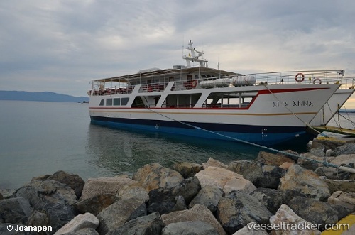
Vessel Agia Anna IMO: 8989513, MMSI: 237010400 Passenger Ro Ro Cargo Ship
UTC, 40.28500, 24.07500, course: -1, speed: 9
UTC, 40.28500, 24.07500, course: -1, speed: 9
2026-02-28 12:42:30 UTC, 40.28500, 24.07500, course: -1, speed: 9
Live AIS position:
UTC. Near Ouranópolis),
updated 2026-02-28 12:42:30 UTC.
Find the position of the vessel Agia Anna on the map. The latter are known coordinates and path.
marine traffic ship tracker show on live map
The current position of vessel Agia Anna is 40.28500 lat / 24.07500 lng. Updated: 2026-02-28 12:42:30 UTCCurrently sailing under the flag of Greece
Details:
Last coordinates of the vessel:
UTC, 40.23667, 24.19667, course: -1, speed: 8UTC, 40.28500, 24.07500, course: -1, speed: 9
UTC, 40.28500, 24.07500, course: -1, speed: 9
2026-02-28 12:42:30 UTC, 40.28500, 24.07500, course: -1, speed: 9