 vesseltracker.com
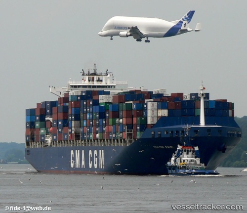
Vessel PORTO CHELI IMO: 9221839, MMSI: 636020869 Container Ship
UTC, 35.55759, -9.02651, course: 85, speed: 12.4
UTC, 35.60968, -8.58396, course: 78, speed: 12.4
2026-02-25 12:07:07 UTC, 35.66326, -7.93190, course: 75, speed: 12.2
Live AIS position:
UTC. 81 nm S of Faro),
updated 2026-02-25 12:07:07 UTC.
Find the position of the vessel PORTO CHELI on the map. The latter are known coordinates and path.
marine traffic ship tracker show on live map
The current position of vessel PORTO CHELI is 35.66326 lat / -7.93190 lng. Updated: 2026-02-25 12:07:07 UTCCurrently sailing under the flag of Liberia
PORTO CHELI built in 2001 year
Deadweight:
79465 tDetails:
Last coordinates of the vessel:
UTC, 35.51811, -9.35436, course: 80, speed: 12.6UTC, 35.55759, -9.02651, course: 85, speed: 12.4
UTC, 35.60968, -8.58396, course: 78, speed: 12.4
2026-02-25 12:07:07 UTC, 35.66326, -7.93190, course: 75, speed: 12.2