 vesseltracker.com
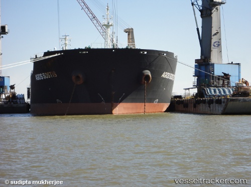
Vessel Agios Sostis IMO: 9473133, MMSI: 636014243 Bulk Carrier
UTC, -27.56651, -13.48756, course: 288, speed: 11.9
UTC, -27.43928, -13.96793, course: 288, speed: 12
2026-02-27 06:19:20 UTC, -27.32333, -14.40167, course: -1, speed: 12
Live AIS position:
UTC. Open sea, approx. 449 nm off the nearest listed port),
updated 2026-02-27 06:19:20 UTC.
Find the position of the vessel Agios Sostis on the map. The latter are known coordinates and path.
marine traffic ship tracker show on live map
The current position of vessel Agios Sostis is -27.32333 lat / -14.40167 lng. Updated: 2026-02-27 06:19:20 UTCDetails:
Last coordinates of the vessel:
UTC, -27.67667, -13.08333, course: -1, speed: 11UTC, -27.56651, -13.48756, course: 288, speed: 11.9
UTC, -27.43928, -13.96793, course: 288, speed: 12
2026-02-27 06:19:20 UTC, -27.32333, -14.40167, course: -1, speed: 12